
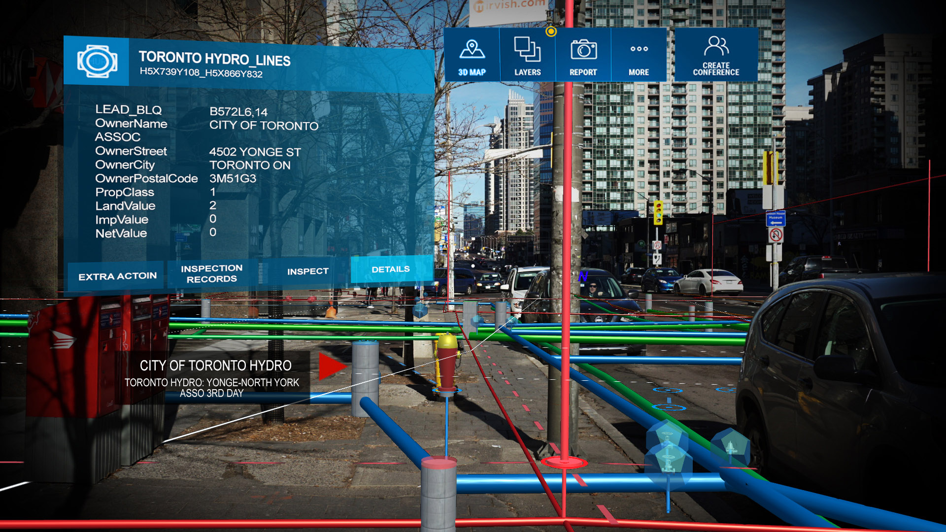
The #1 utility-grade augmented reality (AR) system for Esri GIS designed for municipalities and public utility companies. vGIS Utilities transforms traditional “flat” GIS data into augmented reality displays and holograms overlain on your view of a physical job site.
Use a device already in your pocket—Android phone, iPhone, or a tablet—or even the futuristic Microsoft HoloLens to “see” your underground utility infrastructure as you tour a work area. Water pipes, sewage systems, gas and electrical lines appear in your field of view as a natural extension of the real world.
vGIS creates instant awareness of your surroundings, saving you time and helping you avoid costly mistakes. Explore the case study below to learn more about vGIS’s real-life benefits.
vGIS Utilities increases situational awareness by letting users see the infrastructure around them and a greater understanding of one’s surroundings lead to higher productivity, less human errors and a safer work environment.
A few of many reasons to deploy vGIS Utilities:
- Locate faster
- Respond faster
- See asset relationships
- Improve safety
vGIS Construction natively integrates with Bentley iModelHub, Esri ArcGIS and other BIM and GIS formats to create accurate Augmented Reality (AR) views of surrounding infrastructure on the project site.
A few of many reasons to deploy vGIS:
- Review designs on-site
- Find covert errors
- Survey-grade accuracy
- Show stakeholders visualizations
- Easy to adopt
vGIS Exploration projects mining and exploration data as accurate 3D holograms. Geological information is combined with mine schematics, real-time wellbore information, extraction progress and microseismic to produce comprehensive holographic visuals.
vGIS Exploration holograms can be viewed by multiple users at the same time, simplifying project planning and reviews.